Santorini - Breathtakingly Spectacular
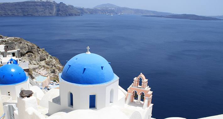
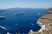
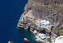
Santorini or Thera, is one of the most picturesque islands of Greece, the rim of a gigantic sunken volcano. Half of island was sunken after a volcanic eruption in 1450BC which destroyed the island's civilization. Santorini today is what remains after the enormous volcanic explosion. Fira, the island's capital, sits on the very rim of the crater nearly 300 meters above the sea with a spectacular view to the sea.
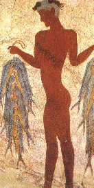 The eruption devastated the nearby settlement at Akrotiri on Santorini, which was entombed in a layer of pumice.
It is believed that the eruption also severely affected the Minoan civilization on Crete, although the extent of the impact is debated.
Early theories proposed that ashfall from Thera on the eastern half of Crete choked off plant life, causing starvation of the local population.
However, after more thorough field examinations, this theory has lost credibility, as it has been determined that no more than 5 mm of ash fell anywhere on Crete.
Other theories have been proposed based on archeological evidence found on Crete indicating that a tsunami, likely associated with the eruption,
impacted the coastal areas of Crete and may have severely devastated the Minoan coastal settlements.
A more recent theory is that much of the damage done to Minoan sites resulted from a large earthquake that preceded the Thera Eruption.
Santorini was named by the Latin Empire in the thirteenth century, and is a reference to Santa Irene. The name Thera was revived in the nineteenth century as the official name of the island and its main city, but the name Santorini is still in popular use.
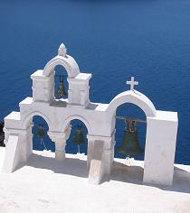
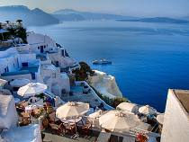
Views from the western coast are spectaculars and sunsets are sensational. Island's architecture is unique with many of 'barrel-roofed' cave houses. The South East coast is covered by black sand beaches which become very hot in the sun.
Santorini's wines are some of the best in Greece and most of them are made from a variety of grapes named "Assyrtiko".
-
Getting There
Daily ferry connections with Piraeus, Crete, Naxos, Paros, Mykonos, Ios. Santorini is also connected with the most islands of Cyclades. Ferries call at Athinios port southern to the Capital Fira. Cruise ships call beneath the cliffs at Fira. Climbing up to Fira can be done by either donkeys or cable car. There are direct schedules from Athens and charter flights from Europe.
-
Getting Around
There is a frequent bus service which operates between Fira, Ia, Perissa, Kamari, Athinios, Akrotiri, Monolithos.
Car and motor bike hire is available. Taxis are also available.
Excursions, Places of Interest
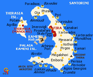 Nea Kameni (appeared in 1720AD), is a volcanic islet. The trip involves 30 minutes walk from
the mooring up to the crater of the islet. Boat trips operate to Thirassia island
(half an hour from Ia), a small island originally part of Santorini until another
eruption-earthquake in 236 BC split them apart.The port village is about
300 steps up the cliff face.
Ia (north of Fira) with spectacular views sitting on the cliff,
Akrotiri (south west) the island's archaeological site are not to be missed.
Perissa and Kamari (south east) are the beach resorts with black sand.
In Fira the Archaeological Museum accommodates finds from
Akrotiri and early Cycladic sculpture. Megaron Gyzi Museum exhibits island's history.
Places to visit
- The New Museum of Fira, which opened in March 2000, is the second largest pre-historical museum in Greece. It exhibits frescoes from Akrotiri and the first golden find in Cyclades.
- The Old Historical Museum in Fira, with finds from Santorini and the Greek Hellenic Period.
- The Archaeological site of Akrotiri, where the ancient town (1500-1600 BC) was destroyed. You can still walk through the streets and houses. (recommended)
- The Nautical Museum in Oia, with rare marine items, models of old and new ships and library.
- Boutaris Winemakers, in Megalohori. Excellent decaration, wine taste and multimedia with the history of the island.
- Megaron Gyzi in Fira, with old clothes, maps and cards from Santorini before the earthquake in 1956.
Touring Santorini
Fira
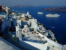 Fira was suffered by the 1956 earthquake is sitting on the edge of the cliff.
It is a lively and very attractive town, with sensational views to the sea and the caldera.
There are plenty of coffee shops and tavernas on the cliff, so be ready to enjoy the sunset while having your drink.
Akrotiri
One and a half kilometer below Akrotiri village, is the archaeological site of Akrotiri which was destroyed by the Volcano erruption in 1500BC.
Akrotiri was buried by volcanic ash and was discovered after excavations began by Professor Marinatos in 1967. No human skeletons or valuable
belongings were found, so it is an evidence that residents had the warning of the eruption and they evacuated the place in time.
Akrotiri had cultural links with Crete and trading activities with Egypt.
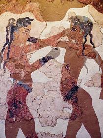
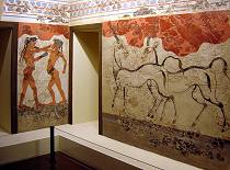
You will walk through the streets, between two and three storeyed houses with squares, workshops and shops. Finds included vases, cooking pots and marvellous frescoes which are in exhibition in the National Archaeological Museum of Athens.
Below Akrotiri is a beach, coffee shops, hotels, rooms and taverns.
Emborio
is a large rural village which with Pyrgos claims to be the oldest village on the island.
Exomitis
is east of Akrotiri and has one of the best preserved Byzantine fortress of the Cyclades.
Finikia
9 Km north of Fira is Finikia, a beautiful small hamlet with very interesting architecture.
Oia
(11 Km north from Fira) was partly destroyed by the 1956 earthquake and is one of the quit places of the island.
It is sitting, or better say, climbing on the hill with barrel-roofed cave houses.
The views are spectaculars and is one of the best places in Santorini to watch and enjoy the sunset. 200 steps lead to the shore at the
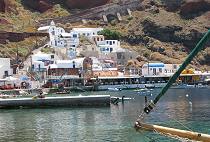
north-west part of the island. From that point you can walk to Ammoudi which is one of Oia's two small harbours.
Ammoudi has small red pebble beach and a taverna.
Kamari
is on the Eastern part of the island with black sand beach. In Kamari there are numerous of tavernas / restaurants, bars, tourist shops, hotels and rooms.
Perissa
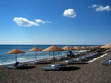 is very similar to Kamari with black sand and plenty of tavernas/restaurants, bars, discos, gift shops,
hotels and rooms. It is separated from Kamari by Mesa Vouno on which stood Ancient Thira the post eruption settlement.
Pyrgos
wis one of the oldest settlements, with old houses and alleys. It is a pleasant hillside village knocked by earthquake in 1956.
Useful Info
Distance from Piraeus Port: 130 Nautical Miles
Medical Center (Fira): 22860 22237
Port Police: 22860 22239
Airport: 22860 31525
Bus Station: 22860 25404
Archaeological Site at Akrotiri: 22860 81366
